Need Help Choosing Marine GPS?
Marine GPS buying guide
Time at sea itself is fun with a spellbound experience! Marine GPS plays an essential role in making it trouble-free and exciting. Believe it or not, it was never easy to find your way home before GPS set out into this world.
Not only does it allow you to enjoy the breathtaking sunset and sunrise views, but it also removes the fear of not finding the right direction.
So, before you go on and buy a not so good GPS out of excitement, it's better to take some time to understand some of the key features in the Marine GPS. This extensive buying guide covers it all to help you make a final decision.
What is Marine GPS and why navigation is essential?
In ancient times, maritime routes were the only way out for trading between various countries. Thanks to merchant ships, many unknown countries and treasures got discovered.
If sea voyages were not made, do you think Vasco Da Gama could ever discover India? Or Christopher Columbus could prove that Earth is not flat; instead, it is round?
The technology was at its infant stage at that time. Due to this, voyagers had to rely on their experience in navigation and find the correct direction. But in the 21st century, everything is possible.
While it is quite challenging to work out when you are in the vast sea, marine GPS is being brought into existence to ease your task.
It is the most valuable possession of any modern-day mariner. GPS or Global Positioning System communicates with the satellites and transmits the information to the receiver. This information tells your exact location in the middle of the sea.
Safety is the primary concern of any individual. It is not apt to travel in the open sea without a GPS navigator.
When the place arrives where you cannot find any direction, and even the shoreline's horizon has disappeared, it becomes very troublesome to find the way back home. You don't want to be stranded.
Your GPS helps you determine your location and trace the correct path that leads to your destination.
Types of GPS
There are many different kinds of GPS available for you. When searching for a GPS designed especially for Marine voyages, you will find three major types based on the size. These are mentioned below.
Handheld GPS
You will find these mounted nowhere in the boat. Just as the name says, these are meant to be carried with you. These have a compact size and are highly portable.
Pros
- Self-reliant, and does not rely on power from the boat.
- It has a colored screen display to allow you to see even in daylight.
- Batteries are used, and once charged, they can provide power for long hours.
- The absence of an external antenna makes it simple to handle.
- It makes it possible to load maps of various locations at any time.
Cons
- The GPS screen is tiny.
- The batteries which power it takes a lot of time to get charged.
Portable GPS devices
These devices give you the liberty of either mounting it on your boat or carrying it in your hands. These also feature different mounting designs that enable you to use it on different mounting devices.
Pros
- These have bigger screens.
- They have more features than their peers.
- These also feature the functionality of a touch screen.
- These can either use their batteries or take the power of the boat.
Cons
- Not a very popular design and it's made by very few companies.
- Although the screens are more prominent, they are not enough to have a clear view at one glance.
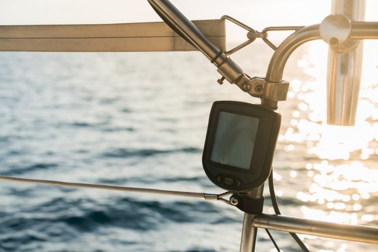
Mounted GPS device
These are mounted on the boat and use the power from the boat to charge themselves. A mounted device is already fixed on the boat on which these devices sit.
Pros
- display screens are broader and brighter.
- These are waterproof.
- These have screens that allow you to read without any difficulty, even in daylight.
- You can draw your chart, or you can plan different routes in these.
- These don't need batteries to charge them.
- They use SONAR for navigation.
Cons
- Mounting devices are not portable.
- They are very costly because of the sophisticated technologies they use.
- You can find several devices that don't provide touchscreen features.
Things to deem about while selecting appropriate Marine GPS
Mentioned below are some of the crucial aspects you should look for before investing in any Marine GPS.
Display
Resolution
Since the screen enables you to draw charts, trace the routes, and much more, it becomes vital to be precise. Having a higher resolution on your screen is vital.
Your eyes get strained a lot; it becomes tough to make out the charts if your screen has low resolution.
Size doesn't matter because some devices with smaller screens also have a high-resolution display. Therefore, you must emphasize more on resolution rather than the size.
Monochrome vs. Color
The traditional GPS devices have black and white screens only. They are cheaper but sometimes challenging to read. In the monochrome version, you cannot figure out the different indications.
If you have a colored screen, it is effortless to use it. Colored screens use different colors for different markings. Once you become familiar with the color codings, navigation will be remarkably smoother for you.
Readability in sunlight
While under the bright sun, you can hardly see anything on the screen because it reflects the light. During this time, sunlight readability mode in your devices becomes extremely helpful.
This mode makes your reading much more comfortable, and you have no problem using it either during day or night.
Transducer
Since many of you do not know this word, getting a basic idea of what a transducer is meant to do is better.
In the famous movie, Titanic, we all have witnessed how the iceberg hits the ship. If a transducer had been used, the disaster could have been avoided. Well, not going deep into what could have been implied then, let's focus on what makes a transducer important.
A transducer is a device embedded in the boat's SONAR system. When your boat's SONAR sends signals to the sea bed, the signals are reflected in the sea surface when hit by any obstacle like a rock.
The transducer then converts this signal in the SONAR to a precise frequency. The same message gets converted into images that inform you about the things under your boat that are likely to hit it.
Marine GPS has a built-in transducer in it. This cuts on the extra expenditure and time that you may spend on finding a separate transducer otherwise. Having a transducer allows you to avoid any accident when you are in the water.
Power
The primary purpose of your GPS is to show you follow the correct path and determine your location. What if it stops working midsea?
To prevent it, you should choose a device that never runs out of power when you need it.
Marine GPS features devices that use batteries or use the power supply of your boat. If you are opting for the handheld or portable devices, search for batteries which assure you long hours of power supply and do not require frequent charging.
If you are opting for the mountable devices, then you don't have to worry at all. That is because mountable devices use your boat's power supply. So, as long as your boat moves, your GPS device will never run out of power.
SONAR
SONAR enables you to get clear images of every element under your boat. It helps you to monitor your boat's depth and avoid any inevitable accident.
Hence, it becomes extremely crucial that your boat is equipped with the SONAR system, whether you are going fishing or on any cruise.
You will find three different frequency ranges for the SONAR. You can choose the one that suits the location that you are planning and the type of activity that you are going to do. After you have decided which one to go for, you can quickly get that frequency range fitted in your marine GPS.
Low frequency
The frequency range is 25kHz to 80 kHz for transmitting clear signals. This frequency range is the best if you plan to sail in deep waters more than 200 feet.
Medium frequency
The frequency range is 80kHz to 160kHz. Using this range, you can easily spot out great fishing locations while sailing in shallow water areas.
High frequency
The frequency range is 160kHz to 800kHz, which is very high. This frequency range gives you high resolution also. You will get to know about every object under your boat when sailing fast. This range is perfect if you are sailing in water that has a depth of up to 200ft.
Mapping system
It is fine to go without any mapping system when you are visiting a familiar location. If you are not, having a mapping system is extremely necessary.
While it is hard to find a location on land, imagine the situation when you are out in the vast unknown sea with no face around to see!
Marine GPS is equipped with an advanced mapping system to enable you to locate yourself in the mid-sea. If you get stranded somewhere, on an island maybe, even then, it will be of real help to send your location to the rescue team.
There are three types of mapping systems available in your GPS device. These are:
Non-mapping:
It includes a basic mapping system. It is designed only to show longitudes, latitudes, distance from the shore, and a basic compass.
Standard base map
These are designed to be used for lakes, rivers, etc. These are also used in cities that have big, well-established ports. These systems have a similar configuration like the GPS we use in our cars but have additional features to overcome the problems faced in water bodies.
Detailed mapping
They use very advanced technology. These enable you to keep a watch on the changing weather and the underwater entities.
Connectivity
Marine GPS uses advanced techniques to make your voyage enjoyable and hassle-free. That includes some of the exclusive features for enhancing the connectivity, which is mentioned below:
Ethernet
Ethernet is used when some large pieces of information need to be communicated. It enables device-to-device connectivity and helps in the same.
NMEA 1083
These include communicating cables. Ensure that other accessories that you are using with these cables are appropriately wired so that they are compatible.
NMEA 2000
These also make use of wires and cables to connect with speed and depth transducers, engine monitors, etc.
Bluetooth and Wi-Fi
These are wireless means used for connectivity. Bluetooth and Wi-Fi help in downloading maps and charts and allow you to share data with other devices.
Storage
Having enough storage is very crucial if you are going to unknown seas. That enables you to save various locations and download many different maps.
Every device has storage that varies according to models. They have precise specifications that provide you with a basic idea of how much space you have and how much freedom of expansion you get.
Getting access to extra memory is a great option, and you should not step back if you get hold of this feature.
A crunch of space will make you run out of storage and not download necessary files. Marine GPS feature devices have enough storage space and SD cards that further expand the space.
These cards feature different shapes and sizes. To get the most out of your device, check how much storage your device has initially and the maximum extent to which it can be expanded. This information will assist you in investing in the right product.
Waterproof
Since you are going to be around water all the time, it is essential to check if your accessories are waterproof or not. Waterproofing helps your devices in staying damage-proof and lasts long.
You might think that all the GPS devices will be waterproof, but this pre-assumption is wrong. You will find that most of the mounted marine GPS is not waterproof. It is because they have very few chances to get dropped into water.
But what if you experience bad weather and some high waves hit your boat? In this case, there is a high chance of your device getting wet. Hence, your device must be waterproof even if it has no chance to get dropped.
Portability
Portability is a significant factor to consider when it comes to GPS. It is fine to use a mounted marine GPS device until you are on your boat. But what if you have to board on another boat due to some emergency?
You cannot leave your GPS behind and go. You cannot even take the risk of dismounting it for an extended period in that situation.
To overcome that problem, you can always rely on a portable GPS device that allows you to either mount or hold your device in hand.
Before investing in a GPS, consider the aspects and be prepared for the likely situations. A single mistake while choosing your device can prove to be fatal.
Price
Price holds the top priority whenever you are investing in something. Do not always chase highly quoted products. That may misguide you sometimes, and you end up purchasing a product with bad quality.
It is always smarter to look for an affordable device that caters to all your needs and a few additional features that may come handy if you plan something extraordinary.
If purchasing a cheaper model, you should not expect it to have an extraordinary feature that is not meant to be included in it.
Therefore, consider all the essential features, your needs, the pros, and cons, and then invest in your favorable marine GPS.
Safety Tips
After you have bought the best possible GPS device that satisfies all your needs, it is crucial to know how it works. You should also know what precautions to take while handling it.
Some of the crucial tips related to safety that you should follow while using your device to experience a smooth voyage are mentioned below.
- Navigation devices are machines and not humans. They can only aid you to some extent. Depending on them entirely is not recommended. You should acquire some basic knowledge of navigation before you set out on your journey.
- If you revisit the location, ensure that the maps you have on your device are the latest. That will provide you with authentic information and help avoid future accidents that you are likely to face.
- The essential safety tip is, get familiar with all the symbols that you have on your device. That will prevent you from panicking while on the voyage.
- While you are planning your route, collect the information about the areas that you will pass to reach your destination. Since GPS leads you to shortcut paths, this information will help you know what lies your way. According to this, you can either alter your route or continue on the same.
How to maintain your marine GPS?
When you care for something, you get the same service in return. The same applies to marine GPS as well.
Since your device will be used every time, irrespective of the weather, it is necessary that you maintain it properly so that it stays for years. Mentioned below are the points that will guide you in keeping your device safe.
Screen
The screen is an essential part of your device. Hence, keeping it clean is very important. If your screen is not visible, you cannot travel even an inch in the sea.
- Please ensure you regularly clean it with a screen cleaner. The fabric you're using should be clean and soft.
- Do not use abrasive cleaners, or even those containing solvents.
Software updates
To get access to the latest information on the weather forecast, length of waves, currents, etc., it is mandatory to update the software in your device at regular intervals.
The best way is to contact any technician or the manufacturer. To get the best results, update the software every time you start your journey.
Replacing instruments
Devices need some amendments from time to time. It can be due to upgrading or any other feature. Before you replace anything, consider the following points:
- If you have issues with your device's screen or its transducer, make sure you call the device's manufacturer and not any other service provider.
- If you are using an old model, the pieces that are no longer in the shops, don't worry, you still have other options.
- Unless the instrument you choose to replace is not connected to any other device, you can easily uninstall the device and find an alternative.
- If the part is attached to a different device or accessory, verify that you have NMEA connectivity. If it does, adopt the same protocol and replace it with a new connecting device compatible with the current one.
FAQs
-
Why is orientation a crucial aspect in Oceans?
As oceans are vast with no specific signs or direction signals, it is vital to know that you are on the correct route to your destination. Marine GPS makes this task hassle-free and provides an accurate direction quickly.
-
What is the underlying working mechanism of Marine GPS?
Marine GPS interacts with satellites to provide your exact location details. They take time as well as direction signs to get the accurate details of where you are present at a particular instant.
-
How can you read Marine GPS?
A Marine GPS can be read easily after you follow the given 3 steps:
- Turn on the functionality of GPS
- Wait for the satellite response
- Read the exact coordinates provided on the GPS
-
Can you carry your car GPS in the sea?
Your car GPS may use the same satellites; it is not the right fit while you are on the sea. They don't have specific navigation maps on coastal areas or any information regarding the sea.
Some Final Words
With this, you must be aware of all the vital features that must include in your ideal Marine GPS. So, all you need to do is start your research with all your desired features and shortlist a few that fit in your budget.
We have also covered all the common doubts in the FAQ section above; you can refer to that for any help you need. Happy Sailing with your Marine GPS!